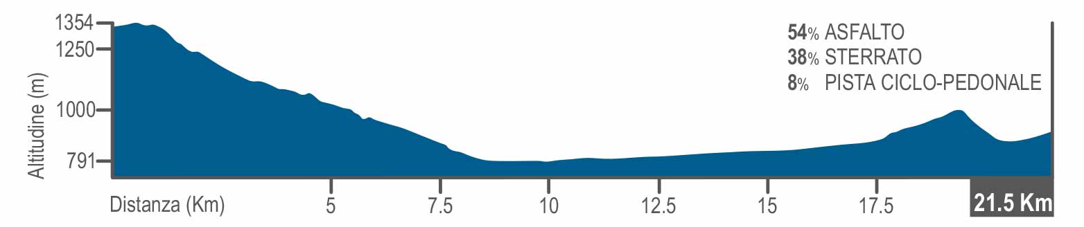
From Pietransieri to Alfedena
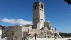
From Pietransieri (Martiri dei Limmari square) you proceed westward on Via Borgo Novo, the SP84. After 1km you turn left on a dirt road. This path, connects Pietransieri to Roccacinquemiglia ( hamlet of Castel di Sangro) and runs adjacent to the Hauptkampflinie, the main fighting line which the Germans made in October 1943. The dirt road runs southward for 3.5 km crossing cultivated fields; keep to the right at the first fork you encounter and take the right at the second to reach Roccacinquemiglia (1040 Metres), a castellated hamlet on a rock outcrop. From Umberto I square you climb up to reach the ruins of San Giovanni church which was destroyed in the bombing, and the bell tower. You exit the village proceeding along ViaSanta Lucia, then SP88, for 1.8 km. At the fork you can follow directions for Castel di Sangro, turning left on SP119.
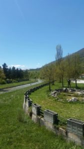
After 1.9 km you cross a long straight tree-lined road, take the bridge over the Sangro and you head to the town centre, passing Corso Vittorio Emanuele. Castel di Sangro (793 Metres) offers the visitor an important chance to discover history and beauty, through its churches, museums and its lively folklore. The trail starts again at the crossroad between Via Riviera and Via Aufidenate, at the north entrance of the town, proceed on the path reserved for bikes and walkers for 1.5 km. The trail runs along the Sangro river for a further 4 km, after which you get back to the tarmac road and turn right towards Villa Scontrone. After 500 Metres you turn left towards the church of Santa Maria del Carmine and proceed south-westward. When the houses start to become less frequent, you begin climbing uphill towards Scontrone, always keeping on the tarmac road. At the fork which follows the cemetery, you turn right and keep on climbing on the provincial road. At the second hairpin turning you keep the left on Via del Commercio, from where it is easy to climb to the centre of Scontrone (1038 Metres) to enjoy the beauty of this picturesque hamlet, as detailed in https://www.borghiautenticiditalia.it. To finish the walk you go downhill by Via Del Commercio, taking the road which delineates the perimeter of the southern part of the town. Going down for about 100 Metres you continue on the trail on the right, keeping to the left on the first and second fork.
The trail goes downhill southward. When you arrive in the vicinity of a hairpin bend you turn right on the provincial road and after about 500 Metres you turn left towards the Sangro river, and then once again go left to the underpass. You walk about 600 Metres of dirt road passing the sporting centre, then you turn right. After a series of steps you turn right on Via Giuseppe De Amicis and proceed towards the centre of Alfedena (914 Metres), You have reached destination point of the journey, the last of the Abruzzo towns ON THE GUSTAV LINE.